
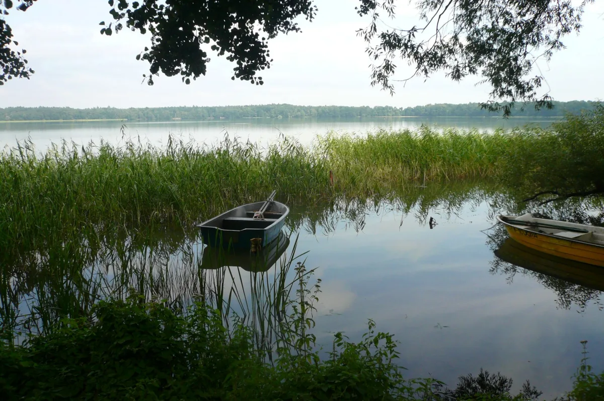
Moryń is a small town on Lake Morzycko in Gryfino County. It has a complete ring of medieval walls, the ruins of a castle on a peninsula, a Romanesque granite church and the centre of a geopark, where mammoth figures meet boulders collected on the surrounding hills. Below is what the sources say about these places, together with discrepancies in dates and figures.
Walls in the shape of a circle
According to Wikipedia, the town walls of Moryń were built of granite and fieldstone, and they surround the town in a circle about 300 metres in diameter. Originally they had 28 quadrangular watchtowers and one gate with a tower. A complete ring of walls has survived to this day, but without the gate and the watchtowers.
The dating is not uniform in the sources. In the part describing monuments, Wikipedia writes that the walls were erected at the beginning of the 15th century. In the historical part of the same article we read that after the town received its charter, which must have been granted before 1306, a ring of town walls was built. Between the early 14th and the early 15th century there is a hundred years' difference, and the article does not explain it. It is possible that different phases of the fortifications are meant, but the source does not say so.
The town developed dynamically in the 14th century. According to Wikipedia, in 1350 the town council took power, and ten years later the town gained judicial authority. In 1353 a ducal mint was temporarily housed here. Moryń also belonged to the league of Neumark towns.
The castle and the Church of the Holy Spirit
Moryń Castle is the ruin of a stronghold on the Zamczysko peninsula. According to Wikipedia, citing the Lexicon of Castles in Poland, it was built around 1370 by the Brandenburgers on the site of a former Slavic stronghold. At the end of the 14th century the castle was destroyed, probably on the orders of Swantibor I, Duke of Szczecin, and never recovered. Fragments of the brick and stone walls of the ground floor survive. The castle originally stood on an island, which was later joined to the mainland.
The Church of the Holy Spirit is a late Romanesque three-nave basilica of cut granite on a Latin cross plan. It was first mentioned in 1263 and 1265, which is why the parish celebrated its 750th anniversary in 2013-2015. The tower with a passage dates, according to the parish, from the turn of the 13th and 14th centuries, according to Wikipedia from the 15th century. In 1756 its uppermost storey was added in wood. Inside stands a granite altar table from the 13th century, and Wikipedia dates the altar as early as the 12th century, that is, earlier than the church itself. The Baroque pulpit of 1711 was made by a Moryń workshop.
The town also has a disused Jewish cemetery. According to Wikipedia it was founded around 1856 and used until 1944, although a plaque from 2006 speaks of the early 19th century. In the time of the Third Reich the cemetery was devastated. Eight gravestones and a pre-burial house have survived.
Morzycko: how deep the lake is
Morzycko lies within the town limits, in the buffer zone of the Cedynia Landscape Park, and Moryń stands on its western shore. According to Wikipedia the lake has an area of 342 hectares and a maximum depth of 60.7 metres, based on the 2006 Catalogue of Polish Lakes. The rowery.wzp.pl website gives a maximum depth of 60 metres and an area of 342.7 hectares. The figures are therefore close, differing by fractions.
Wikipedia and the cycling website agree that it is the ninth deepest lake in Poland, and rowery.wzp.pl adds that it is the deepest in the Western Lakeland. In the central part the bed drops sharply, forming deeps of 30-40 metres, and at such a great depth there is a cryptodepression, that is, a bed lying below sea level. The banks rise 5-12 metres above the water. The most important inflow is the Słubia, flowing out of Lake Białęgi, and the outflow of water is in Moryń itself. An inland bathing area has been designated on the lake.
Geopark Land of Glacier on the Oder
Moryń is the Polish part of a transboundary geopark. Wikipedia writes that its centre has been under development since 2009, and according to the rowery.wzp.pl website the geopark was officially opened on 31 May 2012, thanks to European Union funds. These are two dates concerning different stages: the first the start of work, the second the ceremonial opening. In the longer term the municipalities of Cedynia, Chojna and Trzcińsko-Zdrój are to join the geopark, and its area is to cover about 400 square kilometres, which in the website's description is an announcement, not the actual state of affairs.
The geopark office is housed in a renovated former cinema, and a tourist information point operates there. Along the Great Crayfish promenade, a walking and cycling path 650 metres long leading from the Lake Gate (Furta Jeziorna) to the beach on Morzycko, stand life-size models of the female mammoth Geosia and her son Morynek. The name of the promenade refers to the local tale of the crayfish from the lake, and since 2008 the Great Crayfish fountain has stood in the market square.
In the middle of the promenade the Avenue of Pleistocene Stars was laid out: 10 boards with drawings and descriptions of Ice Age mammals. Wikipedia also mentions models of their tracks and a figure of a woolly mammoth with a calf. The second part is the Stone Garden, an exhibition of several dozen boulders collected from the moraine hillocks around Moryń, with a description of each. For children a sandpit has been created in which they can look for traces of Pleistocene animals.


Be the first! Add a comment.
You need to log in to add a comment.
Log in