
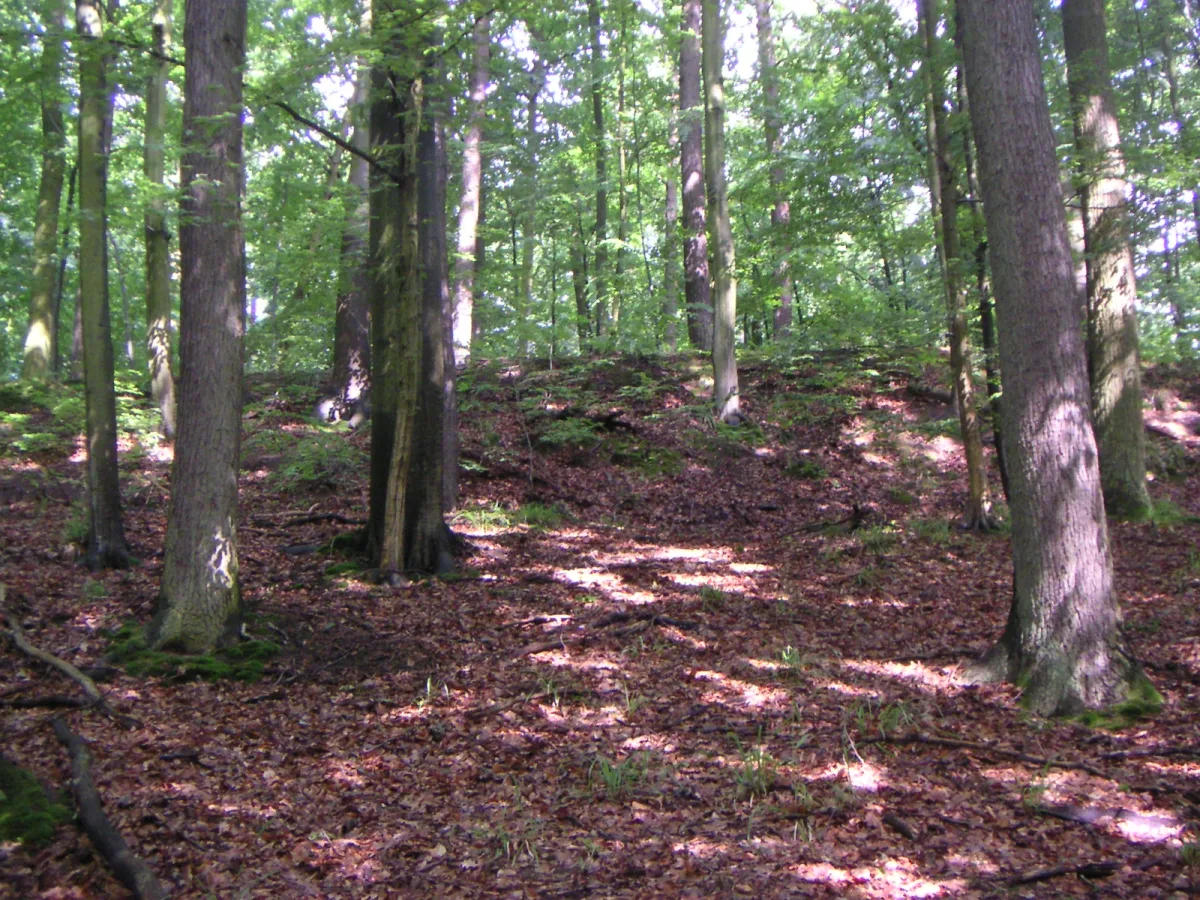
The Beech Forest begins just beyond the south-eastern housing estates of Szczecin. The whole forest complex, which according to Wikipedia lies on the Beech Hills, has been placed under protection as the Szczecin Landscape Park “Puszcza Bukowa”. According to its manager, the Complex of Landscape Parks of the West Pomeranian Voivodeship, it is the landscape park lying closest to Szczecin. Below we set out how the park is laid out on the map, what marks its boundaries and where its relief comes from.
The park in numbers: 1981, 9,096 hectares and a buffer zone
The Complex of Landscape Parks gives 1 November 1981 as the date the park was established. Wikipedia, in its entry on the Beech Forest, simply speaks of a park created in 1981.
The area of the park has changed. According to the manager it was initially 6,700 ha, and the buffer zone, that is the protective strip between the park and developed land, was 15,683 ha. After the boundaries were adjusted in 1989 the park was enlarged to 9,096 ha and the buffer zone reduced to 11,842 ha. The figure of 9,096 ha is therefore the current size of the park as given by the manager, not a round “nine thousand”.
It is worth distinguishing the park from the Natura 2000 site “Wzgórza Bukowe” (Beech Hills), established in 2008. According to the manager it covers 11,987.08 ha and protects 19 types of natural habitat and 12 animal species. The extent of this protection is therefore larger than that of the park alone.
Boundaries and municipalities
The park lies within three units: the city of Szczecin and the municipalities of Stare Czarnowo and Gryfino. Supervision of the park's forest land is exercised by the Gryfino Forest District. Within the park itself are the villages of Binowo, Kołowo and Dobropole Gryfińskie, and in the north the park is reached by wooded areas with Szczecin's buildings.
On the Szczecin side of the boundary, parts of the forest have been developed as municipal woods and forest parks. Zdroje Forest Park covers, according to Wikipedia, 173 ha and is the north-western part of the Beech Forest. Not far away lies Klęskowo Forest Park, with an area of 23 ha, between the Bukowe and Słoneczne housing estates. From Zdroje Forest Park the city can be seen from Wzgórze Akademickie, a hill 51 m above sea level with a partly artificial spoil heap from a former chalk mine. On the northern edge of Szczecin there is also the “Wodozbiór” nature and landscape complex of 63.39 ha, protected by a separate city resolution and not as part of the park.
In the south the park ends at Lake Glinna Wielka, with an area of 75.6 ha, and in the south-eastern part of the forest operates the Glinna Dendrological Garden, managed by the Gryfino Forest District.
The Beech Hills and Bukowiec
According to Wikipedia, the Beech Hills are a mesoregion of the Szczecin Coastland on the right bank of the Oder. The entry describes them as a high moraine ridge whose highest point is Bukowiec, with numerous gullies, ravines and stream valleys. The hills are a belt of older moraines, reshaped at the surface by the last glaciation. The park manager adds that the hills are cut by deep valleys and ravines, and that relative heights exceed 60 m. Some depressions without outflow are filled by lakes and peat bogs. The park includes 17 natural glacial lakes, most of which lie in the south.
The height of Bukowiec is not uniform in the sources. The website of the Complex of Landscape Parks gives 147 m above sea level. Wikipedia gives 148.4 m in the entry on the hill itself, 148.3 m in the entry on the trail to the summit, and 149 m in the entry on the Beech Hills and the Beech Forest. One thing is certain: according to Wikipedia, Bukowiec is the highest point of the main ridge of the Beech Hills and of the whole Szczecin Coastland. At the summit stands a steel observation tower for forest fire protection.
The summit is reached by the black Bukowiec Mountain Trail, 3.8 km long, which begins at the bus terminus in the Bukowe housing estate. The red trail via the Słupi Głaz Boulder starts from the same place.
Water in the forest: lakes and a former quarry
Many hills hold water, but one of the lakes was formed only in the 20th century. Emerald Lake (Jezioro Szmaragdowe) in Szczecin's Zdroje flooded the pit of a chalk and marl mine on 16 July 1925, when a layer of water-bearing sands was hit in the southern wall. According to Wikipedia all the workers then on site managed to escape, and the mine supplied the Stern cement works, founded in 1862. Traces of former industry thus also remain within the park's boundaries.
Beyond that, the Beech Hills form a local watershed. According to the standard data form of the Natura 2000 site, on which the manager relies, water flows from here outwards in numerous streams. Wikipedia assigns the streams to three catchments: the Płonia, the Oder and the Krzekna.


Be the first! Add a comment.
You need to log in to add a comment.
Log in