
A lagoon, not a river mouth
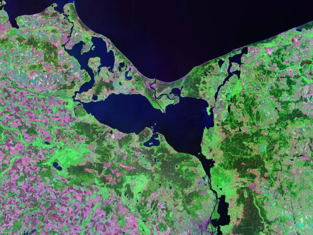
The Szczecin Lagoon is sometimes described as the mouth of the Oder, but according to Wikipedia, which cites a 2004 monograph by Andrzej Osadczuk, it is not an estuary but a coastal lagoon. The same Wikipedia article calls it at once a lagoon and a bay of the Baltic Sea, lying in its southern part. The character of the water body is determined by the wind, which drives the circulation of the water, and by several outflows to the sea instead of one wide mouth. The waters of the lagoon are brackish, that is, slightly saline: according to Wikipedia, the salinity in the central part ranges from 0.5 to 2 per mille, while the water from the Pomeranian Bay has about 6 per mille.
According to the same studies, the Oder supplies about 17 cubic kilometres of water a year, or 94 per cent of the lagoon's water balance. Wikipedia also gives the figure that all the rivers together bring in on average about 18 cubic kilometres a year, so the numbers do not contradict each other, they simply refer to different scopes.
How much water it holds and how shallow it is
The area of the lagoon is, according to various publications, from 666.5 to 687 square kilometres, of which the Polish part is 410 square kilometres, according to data of the Regional Water Management Board in Szczecin cited by Wikipedia. The water body is 55 kilometres long and 22 kilometres wide. The Polish-German border divides it into the German Little Lagoon in the west and the Polish Great Lagoon in the east.
The average depth is 3.8 metres. On the greatest depth the descriptions differ: the Wikipedia infobox gives 10.5 metres, but in the text of the entry, as in the Encyclopedia of West Pomerania, the greatest natural depth is 8.5 metres, and 10.5 metres is the average depth of the artificial Szczecin-Świnoujście fairway. The volume of water, according to Wikipedia, is 2.5825 cubic kilometres. The average annual water temperature is, according to data from 1989-2000, about 11 degrees, and the maximum 26.
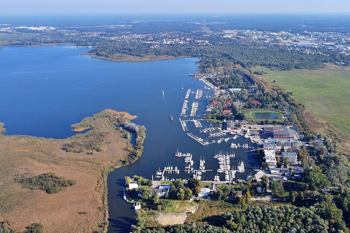
Despite the name, the city of Szczecin itself does not lie on the lagoon. According to the Encyclopedia of West Pomerania, the southern part of the water body is 8 kilometres from the city limits and about 20 kilometres from its centre. Those who want to see the water from the shore usually go to Trzebież, where there is a marina, or to the harbour in Kopice and the harbour on the Młyński Canal in Stepnica.
Three straits to the Baltic
Three straits connect the lagoon with the sea: the Peene in the west, the Świna between the islands of Uznam and Wolin, and in the east the Głęboki Nurt with the Dziwna. Wikipedia cites calculations by Mohrholz and Lass from 1998, which took into account wind strength, changes in water level and salinity: 69 per cent of the water flows out through the Świna, 17 per cent through the Peene, and 14 per cent through the Głęboki Nurt and the Dziwna. Salt water usually does not flow beyond the area of the back delta of the Świna, although a strong current can sometimes carry it into the lagoon for several kilometres.
Formally, according to Wikipedia, the lagoon is classed as internal sea waters. For that reason there are seaports on its Polish shore: Trzebież, Stepnica and Nowe Warpno, and in the neighbouring water bodies, that is, on the Świna, Wicko Wielkie, the Dziwna and the Oder, there are eleven other Polish seaports. On the German side Wikipedia lists ports at Kamminke, Mönkebude and Ueckermünde.
Ice, icebreakers and islands made of dredged spoil
According to the Encyclopedia of West Pomerania, ice phenomena on the lagoon occur from mid-December to mid-March. This information comes from a single study, so treat it as an indicative period, not a rule. The Szczecin-Świnoujście fairway, which crosses the lagoon over a stretch of 19.5 kilometres, requires, according to Wikipedia, constant monitoring and dredging, and during icing it is watched over by icebreakers.
The lagoon contains natural islands, such as Łysa Wyspa, which closes off Lake Nowowarpieńskie, and Wichowska Kępa on the Roztoka Odrzańska. There are also artificial islands, heaped up from spoil dredged during deepening work: Chełminek and Wyspa Refulacyjna, both near Trzebież.
Former names
In German the lagoon was called Stettiner Haff, Oderhaff or Pommersches Haff. The Polish names changed over time. According to Wikipedia, the name Zatoka Julińska (Julin Bay) appears on a map from the Diplomatic Code of Greater Poland of 1881, the Geographical Dictionary of the Kingdom of Poland of 1890 gives Zatoka Szczecińska (Szczecin Bay), and the name Zalew Szczeciński appears on a map of the Military Geographical Institute of 1938.
A cycle loop also runs around the lagoon, crossing the Polish-German border, so the lagoon can also be explored from the land side.
Be the first! Add a comment.
You need to log in to add a comment.
Log in