
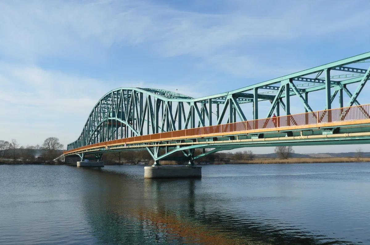
Near Szczecin the Oder does not flow in a single channel. Near Widuchowa it splits into two arms, and each has a different history, a different role and a different name along its course. According to Wikipedia the split takes place at kilometre 704.1 of the river, and the two branches together mark out the Międzyodrze area (the Oder floodplain). Anyone who wants to understand why the Szczecin bridges stand where they do should start with this fork.
Two arms, three names
According to Wikipedia the West Oder is the river's original channel. Its upper section, 17.1 km long, forms the Polish-German border, and above the village of Pargowo it stops being a border river. The East Oder between Widuchowa and Gryfino, on the other hand, was created as an artificial cut at the beginning of the 20th century. Today most of the Oder's water flows through it, and according to the Encyclopaedia of West Pomerania it is a 26.4 km section of the waterway along which ships travel from the upper course of the river to the port in Szczecin.
At the start of the West Oder stands a sluice weir from 1914, 78 m long. Wikipedia says it was meant to direct water into the new channel of the East Oder and protect the older channel from excessive erosion. Both rivers belong to navigation class Vb, that is, they are part of the same Oder waterway.
The names change along the course. According to Wikipedia the East Oder ends at Klucz in Szczecin. Further on, as far as Lake Dąbie, the arm is called the Regalica, a name introduced officially in 1949 in place of the German name Grosse Reglitz. From the mouth of the Parnica to the lake the same stream is called, according to Wikipedia, the Mienia, in German Mönne. The same Wikipedia entry also preserves a curiosity from older dictionaries: in the Geographical Dictionary of the Kingdom of Poland of 1886 the East Oder appears under the name Żuraw.
Naming is sometimes inconsistent in the sources. The entry on the Regalica lists the drawbridge in Gryfino among the bridges on that river, while the entries on the East Oder and on the Gryfino bridge itself place it over the East Oder. For the description of the crossing in Gryfino I therefore follow the version from the entries on the bridge and on the East Oder.
Backwater from the Lagoon and water that changes direction
According to Wikipedia the section of the East Oder as far as Gryfino, that is up to kilometre 718.5, has a river-and-sea character, and closer to the Szczecin Water Junction it becomes increasingly maritime. The influence of sea levels and the Szczecin Lagoon is visible there: a northerly wind causes backwater, while a southerly wind lowers the water level. The lower the flow in the river, the stronger the effect of northerly winds. For someone standing on a bridge and looking at the water, this means that the level of the river depends on the weather over the Baltic as much as on rain in the upper course.
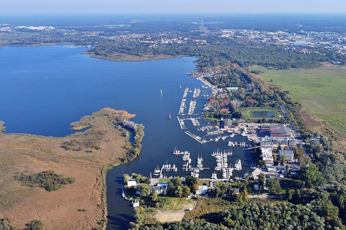
The waters of the East Oder then spread in two directions. Part of the flow goes along the Skośnica stream to the West Oder, and the rest goes along the Regalica to Lake Dąbie and returns through channels to the main stream of the river. Between the Regalica and the West Oder lies Międzyodrze, and according to Wikipedia the two rivers are linked by the Skośnica, the artificial Kanał Leśny, the Parnica and many channels on Międzyodrze itself.
Bridges on the West and East Oder in Gryfino
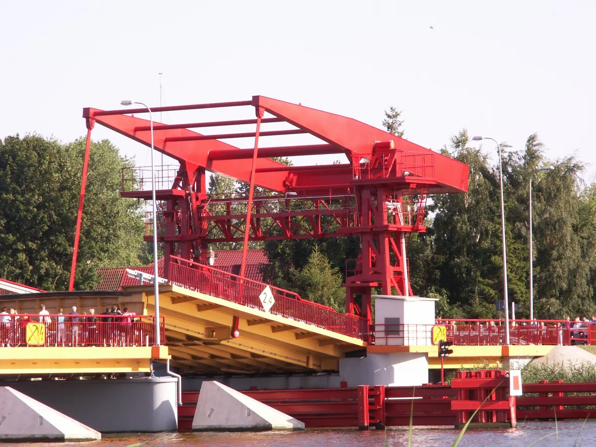
According to Wikipedia the first bridge over the East Oder is the one in Gryfino, on voivodeship road no. 120, and the same road continues across the West Oder to the village of Mescherin in Germany. The first bridges on both arms were started in 1306, together with a causeway across Międzyodrze. In 1640 the retreating Swedes burned them during the Thirty Years' War. Today's drawbridge in Gryfino is a steel truss from 1911-1913, blown up in its central part in 1945 and rebuilt in 1955. Wikipedia states that navigation class Vb assumes a clearance of 5.25 m while the bridge has 5.17 m, so according to this description it does not need to be raised. Further upstream the East Oder is crossed by the A6 motorway: according to Wikipedia the steel bridge here is 266.10 m long and 13.40 m wide, and over the West Oder 244.70 m.
Szczecin: a bridge on each arm
Długi Bridge, spanning the West Oder, is according to the Encyclopaedia of West Pomerania the first bridge of the city, mentioned in 1283. For centuries it was wooden and fixed, and according to the Encyclopaedia it also served as the southern boundary of the river and sea port. It received a drawbridge span with two lifting leaves in 1820. Ships up to 11.2 m wide could pass through it, and after the reconstruction the whole bridge was 105 m long. A new drawbridge, known as the Hanseatic Bridge (Most Hanzy), was opened in 1903. Its leaves lifted in 20 seconds, and tram tracks ran along the roadway. The retreating German troops blew it up on 20 April 1945.
A wooden deck was laid first on the piers. The Encyclopaedia describes how on 19 September 1947 a ceremony handing the port of Szczecin over to the Polish authorities was held on it. The year the bridge was rebuilt differs between two sources: the Encyclopaedia of West Pomerania gives 1957, Wikipedia 1959. Both agree that the bridge was a drawbridge until 2000, when it was welded in place during renovation.
The second crossing is Cłowy Bridge on the Regalica. According to the Encyclopaedia of West Pomerania its beginnings go back to the early 14th century, when customs duty was collected here from passing ships. The present name derives from the German name Zollbrücke. The bridge was part of a route known as Kamienna Grobla (the Stone Causeway), which connected Szczecin with Dąbie and the rest of Pomerania. In 1909-1911 the city built a new drawbridge 195 m long, and after it was destroyed in the war a temporary Bailey-type structure on wooden supports was built in 1947. The present prestressed concrete bridge was opened in 1960. Before it was handed over it was loaded with nine tanks of 34 tonnes each, and its total length was 204.85 m. In 2016, according to Wikipedia, the crossing was closed because of its technical condition, and in 2017 new steel spans were installed on the old piers and abutments, two segments measuring 14 by 100 m.
There is also a railway crossing: according to the Encyclopaedia of West Pomerania, six railway bridges stand over Międzyodrze, including a drawbridge over the Regalica. The lifting span of this bridge was entered in the voivodeship heritage register under number 545 by a decision of 7 December 2009.
How to see it
The easiest way to see both arms is from the bank in Szczecin and in Gryfino, and from the water this can be done on a kayak trip along the routes of the Lower Oder Valley Landscape Park. The bridges are working crossings and some of them carry tram or road traffic, so it is best to view them from the quays and boulevards.
Be the first! Add a comment.
You need to log in to add a comment.
Log in