
A park in three voivodeships
Drawa National Park was established on 1 May 1990 in the Drawsko Forest, on the Drawsko Plain. It lies on the border of three voivodeships: West Pomeranian, Lubusz and Greater Poland, so it is hard to describe it as an attraction of a single region. Wikipedia states that at the time of its establishment it covered 8,691.50 ha, and today it covers 11,535.66 ha (115.36 square kilometres). Of the land held by the park in perpetual usufruct, that is 11,210.69 ha, 5,470.67 ha lie in the West Pomeranian Voivodeship (Choszczno and Wałcz counties), 5,362.18 ha in the Lubusz Voivodeship (Strzelce-Drezdenko County), and 377.84 ha in the Greater Poland Voivodeship (Czarnków-Trzcianka County). A buffer zone of 352.67 square kilometres has been designated around the park.
The park's headquarters is in Drawno, in the West Pomeranian Voivodeship. According to Wikipedia, the southern boundary of the park runs along national road no. 22. The main water axis is the Drawa River and its tributary the Płociczna, which flow through a wide belt of outwash plains. According to the park, the whole area lies in the Drawa catchment.
How the park came into being
From the history of the park, described on its website, it follows that scientific research in the Drawsko Forest began in 1969, and the “Rzeka Drawa” reserve was established in 1974. At the turn of 1978 and 1979, members of the Voivodeship Nature Protection Committee in Gorzów Wielkopolski, together with the League for Nature Protection, submitted a proposal to create a park. By a resolution of the State Nature Protection Council of 30 October 1984 the park was entered on the list of planned national parks, and preparatory work continued until 1985. Research was carried out by teams from Poznań, Gorzów and Szczecin.
Strict protection and lakes
According to Wikipedia, forests cover 83 per cent of the park's area, mainly beech woods, oak-beech forests and pine forests, and about 10 per cent is water. Strict protection covers 1,391.62 ha in 12 areas, active protection 9,609.27 ha, and landscape protection 534.77 ha. Seven areas of strict protection lie in the West Pomeranian Voivodeship: Przełom Drawy, Runica, Głodne Jeziorka, Sicienko, Pustelnik, Wydrowe Łęgi and Dolina Płocicznej. The remaining five, including Lake Czarne and the islands and peninsulas of Lake Ostrowieckie, lie, according to Wikipedia, in the Lubusz Voivodeship. In the park's buffer zone there are five nature reserves: four in the West Pomeranian Voivodeship (Leśne Źródła, Mszary Tuczyńskie, Stary Załom and Torfowisko Konotop) and one in the Lubusz Voivodeship (Torfowisko Osowiec).
Wikipedia speaks of 20 bodies of water, including Lake Czarne, which it calls unique on a national scale. The largest, according to the park, is Ostrowiec with an area of 369.87 ha, and together with lakes Głuchy Duży and Głuchy Mały, which are sometimes jointly called Lake Ostrowieckie, it covers 387 ha. Martew, in turn, according to the park, covers 73.69 ha and is up to 25 m deep, and the emerald colour of the water is a feature of lakes with calcium-rich water.
Otter, beaver and fish
The park gives 51 species of mammals, whereas Wikipedia gives about 50. The symbol of the park is the otter, which the park management calls an indicator of clean waters. The European beaver also occurs here, and in the park and its buffer zone, according to the management, the presence of wolves and lynxes has been recorded, although these animals are hard to observe. Wikipedia also lists alien species: the raccoon dog, the raccoon and the American mink. Thirteen species of bats have been observed, all under strict protection.
According to the park there are 39 species of fish and one species of lamprey, while Wikipedia speaks of about 30 species. The Drawa and the Płociczna have a swift current and a stony and gravelly bed. The park writes that until the mid-1980s a population of Drawa salmon lived here, in 1962 a salmon 144 cm long and weighing 24 kg was caught, and at the end of the 1980s the population practically disappeared. A restitution programme began in 1995, with more than 20 thousand smolts released. Grayling and three forms of trout also live in the rivers, and the vimba bream, considered by the park to be critically endangered on a national scale, forms local lake-and-river populations here. Vendace inhabits, among others, lakes Pecnik Duży, Płociowe, Marta and Ostrowieckie, and lake whitefish lakes Ostrowieckie, Marta and Czarne.
Educational trails and the surroundings of Drawno
According to Wikipedia, five educational trails marked with green fir trees on a white square have been laid out in the park: Drawnik (4 km), Barnimie (3 km and 4 km), Międzybór (4 km) in the north-western part, and Głusko (3 km) and Lake Ostrowieckie (7 km or 5 km) in the southern part. There is also the geological trail “Petrography of the lands along the Drawa”, 3.8 km long.
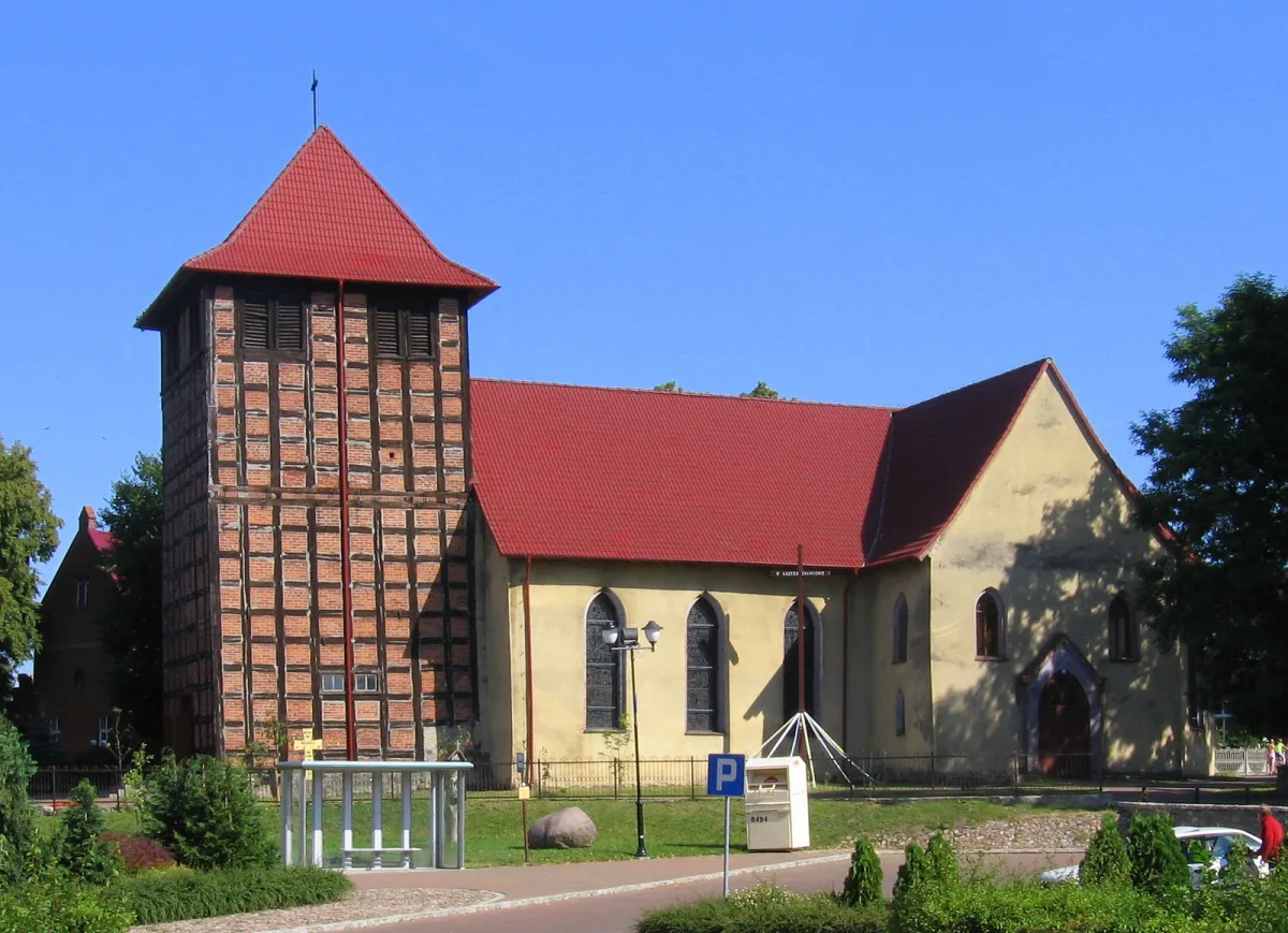
The road to the park often leads through Drawno on Lake Rudno. Here stand the ruins of the Wedel castle from the turn of the 13th and 14th centuries, and next to it the Gothic Church of Our Lady of Perpetual Help, which after the fire of 1690 was rebuilt as a largely Baroque church. In a former granary there is the Museum in the Granary with an exhibition on the history of the town and its surroundings. The red Hetman Stefan Czarniecki Trail from Stargard to Kostrzyn nad Odrą leads, according to its description, through Drawa National Park and the Drawsko Forest, and in the West Pomeranian part passes, among others, Recz and Drawno.


Be the first! Add a comment.
You need to log in to add a comment.
Log in