
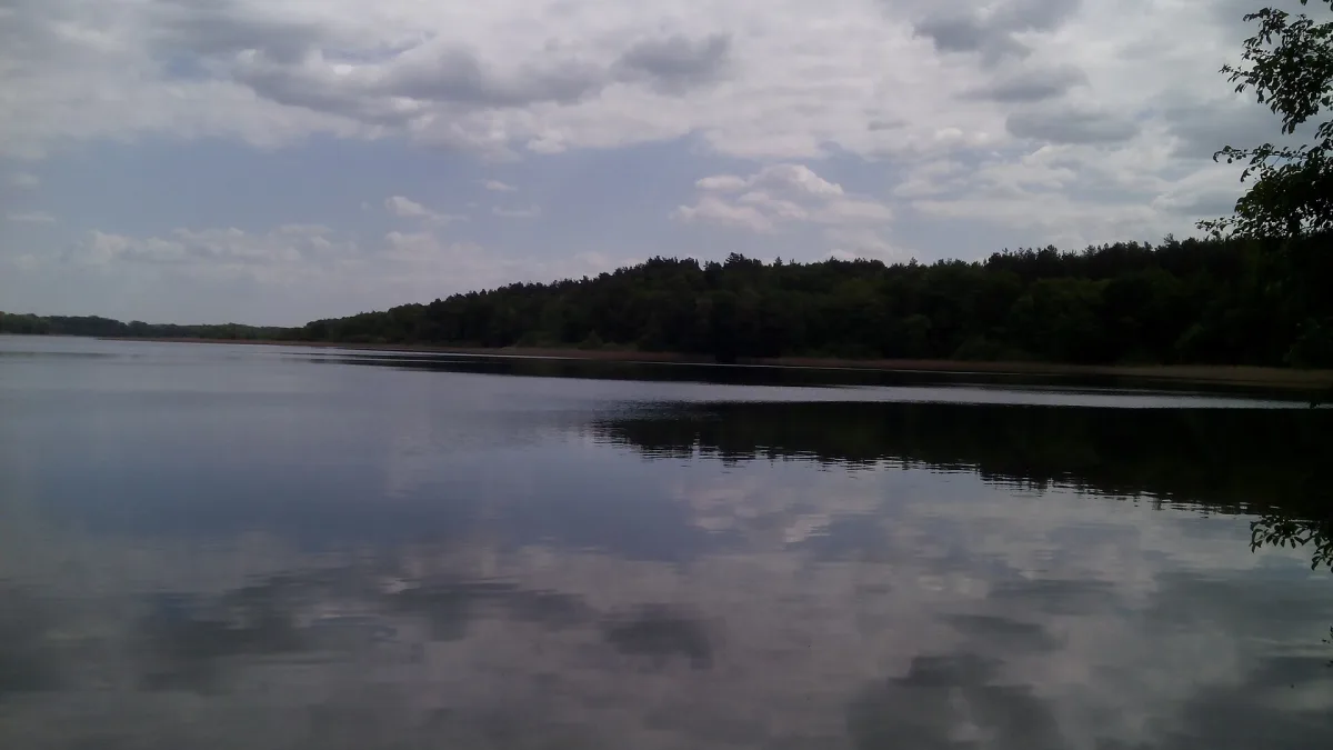
Second after Hańcza, but how many metres does it really have
The list of lakes deeper than 50 metres kept by Wikipedia on the basis of the Catalogue of Polish Lakes gives Drawsko second place in the country: 82.2 m, behind Hańcza, which is entered with 106.2 m (a Wikipedia footnote adds 113 m according to the weekly Wprost). Third on this list is Wielki Staw Polski in the Tatra Mountains, at 80.3 m. The title of the deepest lake in Poland therefore belongs to Hańcza, and Drawsko is the deepest in the West Pomeranian Voivodeship. Second place in the country is also confirmed by the Complex of Landscape Parks of the West Pomeranian Voivodeship.
The figures for the lake differ depending on the source. Wikipedia, citing a 1991 publication, gives 82.2 m maximum depth, 17.7 m average depth, an area of 1781.5 ha and a water volume of 331,443.5 thousand m³. In the table of deep lakes, however, the same Wikipedia enters 1797.5 ha. The municipality of Czaplinek, in its presentation of the lake, speaks of 1871 ha and 83 m, and estimates the shoreline at 68.37 km. According to the municipality it is the twelfth largest lake in Poland. According to Wikipedia the greatest length of the water body is 10.6 km and the width 6.6 km, and the water surface lies at an elevation of about 128.7 m above sea level. The measurements were made by different methods and in different years, so each of the values is best read as approximate.
Channels that cross here
According to Wikipedia the lake formed where several deep glacial channels cross. Wikipedia classes it among the channel lakes. The Scandinavian ice sheet sculpted this area, as the manager of the landscape park writes, several thousand years ago, and it left behind end moraines, kettle holes and eskers in the landscape. The shape of the channels can be seen on the map: the lake has long, narrow bays that extend in different directions.
For comparison, in the same area lies Siecino in the municipality of Złocieniec: according to Wikipedia 729.7 ha and up to 44.3 m deep, with water classed as purity class I. Lake Lubie, through which the Drawa also flows, has according to Wikipedia 1487.5 ha and up to 46.2 m. Such comparisons show how much Drawsko stands out for its depth.
Twelve islands and cormorants
According to Wikipedia there are 12 islands on the lake: Lelum, Polelum, Mokra, Środkowa, Zachodnia, Bagienna, Samotna, Dzika (also called Bobrowa), Żurawia, Czapla, Kacza and the largest, Bielawa. Wikipedia gives Bielawa as about 80 ha and the municipality as 79 ha, and according to Wikipedia it is the fifth largest lake island in the country.
Wikipedia describes Wyspa Samotna, lying about 200 m from the end of the Bielawa peninsula, as small and inaccessible, with trees almost completely destroyed by the cormorants living there. The municipality of Czaplinek lists cormorants among the lake's problems: according to it, the colonies grow unhindered, destroy fish stocks and devastate the tree stands on the islands, Bielawa included.
The landscape park and nature reserves around the lake
The lake lies within protected areas. Drawsko Landscape Park was established in 1979 and according to Wikipedia covers 38,360.17 ha. More than 40 protected plant species occur in it, and 148 bird species breed there, among them eagles, herons, cranes, the black stork and the cormorant. According to Wikipedia the park has seven nature reserves and two more in its buffer zone, and there are about 300 natural monuments. The municipality of Czaplinek reports that in 2023 the park within its area was extended to include the Lobelia Lake area. The lake is also part of Natura 2000 areas: the bird area Ostoja Drawska and the habitat area Jeziora Czaplineckie.
The park's reserves show how varied the waters are here. Jezioro Czarnówek nature reserve near Złocieniec protects, according to the manager, a water body unique on a European scale, with the relict water lobelia. According to Wikipedia it is a lobelia lake with an area of 11.88 ha, under strict protection, so it is viewed from the trail. The Torfowisko nad jeziorem Morzysław Mały nature reserve protects a mesotrophic lake and peat bogs, where round-leaved sundew and the marsh orchid grow. The Jezioro Prosino nature reserve covers 86 ha and protects wetland birds, among them the crane, the bittern and the common tern. The tiny Brunatna Gleba nature reserve is only 1.10 ha and protects forest brown soil with distinct horizons.
Along the road from Połczyn-Zdrój to Czaplinek stretches the Dolina Pięciu Jezior nature reserve, known as the Połczyn Switzerland. The sources of the Drawa lie there, and it later flows into Drawsko. In the Przełom rzeki Dębnicy nature reserve, in turn, the river cuts through a ridge of end moraine, and the park manager notes that the grey wagtail nests there, a bird associated with mountain streams.
Water that needs care
Wikipedia states that in 1996 the waters of the lake were assessed as purity class III, and studies from 2009 showed a moderate ecological status and a good chemical status, with an overall assessment of the state of the waters as poor. Among the threats the municipality of Czaplinek lists recurring blue-green algae, which force the temporary closure of the town bathing area, as well as sewage discharges and littering of the shore zone. According to the manager of the landscape park, Drawsko is the start of the kayak route down the Drawa River.
On the shore also stands Drahim Castle in Stare Drawsko, at a site that Wikipedia, following a description from 1565, places between Lake Drawsko and Lake Zarębie, that is, today's Żerdno.


Be the first! Add a comment.
You need to log in to add a comment.
Log in