
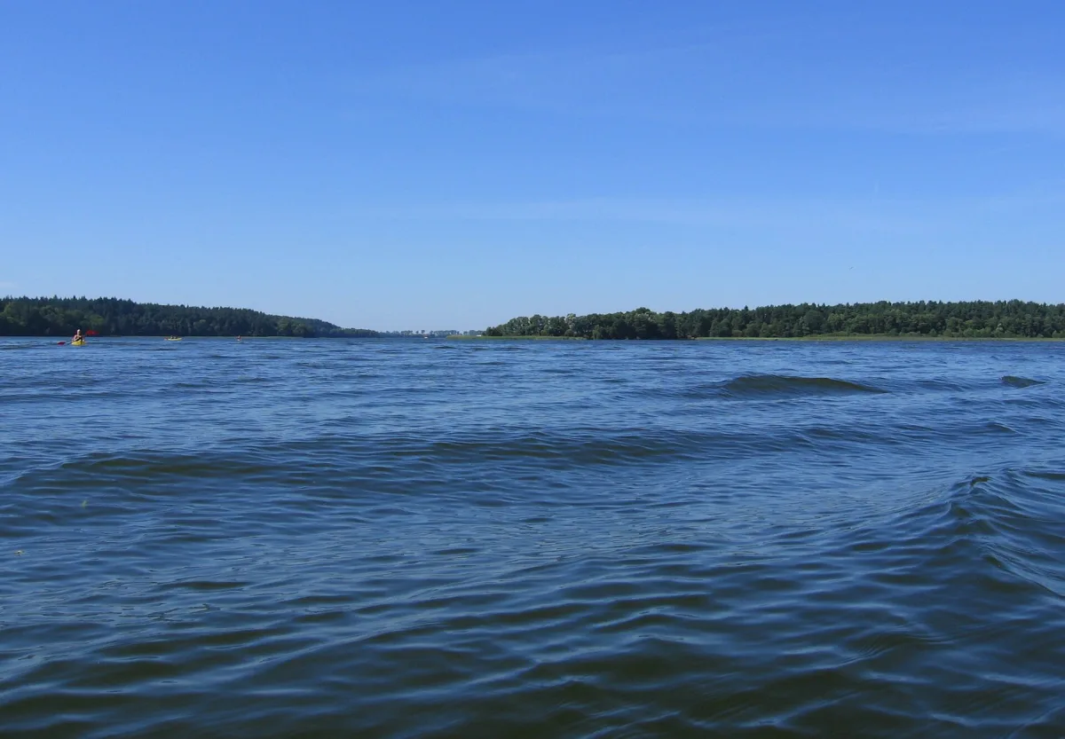
The Drawsko Lakeland and the neighbouring Ińsko Lakeland have a great many lakes, but four of them show well how much lakes can differ. Lubie is deep and borders a military training ground, Ińsko lies in a landscape park, Wielimie covers more than sixteen hundred hectares and is only a few metres deep, and Woświn is the largest lake in the Rega River basin. The data come from Wikipedia entries, which cite lake catalogues, and where their figures diverge we quote both.
Lubie: a deep lake and a training ground on the south side
According to Wikipedia, Lubie lies south-east of Drawsko Pomorskie, in the municipality of Złocieniec. The water surface covers 1487.5 ha and lies at an elevation of 95.5 m above sea level, the length of the lake is 14.1 km, and the greatest depth reaches 46.2 m. There are five islands on the lake: Sołtysie, Rybaki, Kamieniec, Ptaszyniec and Wyspa Bezimienna. The Drawa River flows through Lubie.
The southern shore is covered by the Karwice Forests (Bory Karwickie), and the Drawsko Training Ground (Poligon Drawski) is located within them. Wikipedia notes that this part of the shore is inaccessible to civilians, so tourist traffic is concentrated on the other shores, near the villages of Gudowo, Lubieszewo and Karwice and the settlement of Błędno. The Karol Wojtyła kayak trail runs through the lake, and around it a cycling route about 50 km long.
Studies in 1998 and 1999 confirmed populations of the relict glacial crustaceans Mysis oculata and Pallasea quadrispinosa in Lubie. These are species left over after the last glaciation in cold, deep water bodies. Until 1945 the lake bore the German name Gross Lübbe-See, and the current name was introduced officially in 1949.
Ińsko: a lake in a landscape park
According to Wikipedia, Lake Ińsko has an area of 596 ha, including three islands with a combined area of 22.3 ha, and is 5.4 km long, 2.1 km wide and up to 42 m deep. The shoreline is well developed and measures 32 km. The banks are mostly high, in places steep, because they are formed by moraine hills up to about 30 m high, and the northern ones are wooded. The lake bed is very varied, because the lake consists of several channels.
The two sources report different sizes. Wikipedia gives 596 ha and 42 m, while the Nurkomania website, intended for divers, gives 487 ha and 41 m, with the same length of 5400 m and width of 2100 m. A difference of 109 ha is too large to be put down to rounding, so it is best to treat both figures as data from different measurements.
The lake forms part of the Ińsko Landscape Park and the Ostoja Ińska bird area in the Natura 2000 network. The largest of the islands, the Wyspa Sołtyski nature reserve, covers about 20 ha, and on the north-eastern shore lies the forest Kamienna Buczyna nature reserve. The Ina River flows through Ińsko and links it with Lake Stubnica. The waters have been assessed as purity class I, and the lake is home to the Pallasea quadrispinosa crustacean, a relict species rare in Poland.
Wielimie: huge and shallow
Wielimie in the municipality of Szczecinek is the opposite of Lubie. Wikipedia gives an area from 1637.5 ha (Catalogue of Polish Lakes, 2006) to 1754.6 ha (according to the Inland Fisheries Institute), that is, more than Lubie, but the maximum depth is only 5.5 m and the average 2.2 m. The water surface lies at an elevation of about 132.6 or 132.7 m above sea level. Studies from 2003 placed its waters in purity class III.
The Gwda River flows through the lake, and the Nizica, which flows out of Lake Trzesiecko, runs into it. The main basin is partly hidden by the huge Wyspa Owcza (Sheep Island), which according to Wikipedia covers 96.13 ha and is the largest island within a lake in Poland. The view over the broad expanse of water, as Wikipedia writes, can be had only from around the village of Gwda Wielka, about 10 km from Szczecinek.
The lake was once larger and deeper. Wikipedia describes how at the end of the 18th century, after floods and flooding in Szczecinek, residents brought specialists from the Netherlands, who lowered the water level of Wielimie and Trzesiecko. The south-western shore turned into marshland, and the arm near the town became inaccessible.
Woświn: the largest in the Rega basin
Woświn lies in the municipality of Węgorzyno, in Łobez County, in the Ińsko Lakeland. According to Wikipedia it is one of the largest lakes of this lakeland and the largest in the Rega basin. The area is from 767.5 ha (Catalogue of Polish Lakes) to 809.7 ha (Inland Fisheries Institute), the length about 9.5 km, the width about 2 km, the maximum depth 28.1 m and the average 9.4 m.
It is not, however, the longest lake in the region: at 9.5 km Woświn is shorter than Lubie, which is 14.1 km long. The lake lies in the Ińsko Landscape Park and is also included in the Ostoja Ińska bird area. In 2000 its waters were assessed as purity class II.
The name is recorded as early as 1284 as Woswin. Wikipedia cites a hypothesis of a Baltic origin of the name, from the Lithuanian word aszwa, meaning mare, as well as an attempt at a Slavic etymology linking it with the aspen.
Four figures side by side
A comparison according to Wikipedia. Area: Wielimie from 1637.5 to 1754.6 ha, Lubie 1487.5 ha, Woświn from 767.5 to 809.7 ha, Ińsko 596 ha. Maximum depth: Lubie 46.2 m, Ińsko 42 m, Woświn 28.1 m, Wielimie 5.5 m. The largest lake is therefore not the deepest, and the deepest is not the largest.
For comparison, Lake Drawsko has, according to a presentation by the municipality of Czaplinek, 1871 ha and a depth of 83 m, while Wikipedia gives 1781.5 ha and 82.2 m. Meanwhile Lake Pile near Borne Sulinowo, the largest body of water in the Szczecinek Lakeland, has according to Wikipedia 980.1 ha and a depth of up to 43.9 m. The Drawa flows through Lubie, the Gwda through Wielimie, and Woświn and Ińsko lie within the boundaries of the Ińsko Landscape Park.


Be the first! Add a comment.
You need to log in to add a comment.
Log in