
For more than two centuries Kołobrzeg was a fortress, and traces of that period are scattered across the whole town: from medieval towers in the centre, through redoubts by the port, to a redoubt in the dunes by the sea. According to Wikipedia many of the fortress's structures have survived, although some were destroyed after the war, and there is no single route or common entrance. Below is the order from the oldest walls to the works of the 19th century, with what stands in their place today.
From medieval walls to the Dutch-style fortress
According to Wikipedia, the few remnants of the walls of the chartered town founded in 1255 are all that survived from the time before the early modern fortress. They are best seen in the Match Tower (Baszta Lontowa), built in the 14th century. The Wikipedia entry calls it the only completely preserved element of the walls, and regards the name Baszta Prochowa (Powder Tower) as an error resulting from an incorrect translation of the German name. The second surviving medieval tower is the Prison Tower (Baszta Więzienna) from the 14th century, part of the northern section of the walls. Of the building only the ground floor and one wall of the first storey remain, secured as a permanent ruin, and it stands in a courtyard on Wąska Street, so it is viewed from the outside and quietly, because it is a residential estate.
The early modern fortress was decided by the Thirty Years' War. According to Wikipedia, in 1627 imperial troops occupied West Pomerania, and their engineers began to modernise the damaged fortifications. In 1630 the town was taken by the Swedes, who added earth ramparts and bastions. When the Swedes left Kołobrzeg in 1653 and the town became the capital of the Brandenburg province of Pomerania, Elector Frederick William decided to preserve its military character. From the second half of the 17th century to the beginning of the 18th century fortification works were built around the town according to the Dutch art of fortification. In this work the remains of the medieval walls were demolished, and the Parsęta River and the waterlogged meadows were used for a system of sluices which, in case of danger, allowed the surroundings to be flooded and the town turned into an inaccessible island. Of the 17th-century bastions themselves little remains in the Kołobrzeg Fortress: Wikipedia mentions a brick wall and stone foundation of the former Magdeburg bastion, on whose site there are now a car park and warehouses.
The port: Ujście Fort, Morast Redoubt and the lighthouse
According to Wikipedia, Ujście Fort was built in 1770-1774 at the mouth of the Parsęta, on the site where an earth redoubt had stood since 1627. The reason was the wartime experience of 1760-1761: it turned out that the existing fortifications would not prevent the capture of the naval port. The core of the fort is a three-storey brick rotunda, which had a storeroom in the cellars, space for infantry on the ground floor and an artillery position above. Today there is a café in the cellars of the rotunda, and a viewing terrace on the lighthouse. According to the same entry, in 1945 the fort was the last German point of defence of the fortress, evacuated on the night of 17 to 18 March, and after the war Soviet soldiers built a new brick lighthouse on the rotunda.
On the other side of the entrance to the port, on the northern tip of Salt Island, lies the Reduta Bagienna, that is the Morast Redoubt. It was built in 1770-1774, at the same time as Ujście Fort, and together they guarded the mouth of the Parsęta. In 1832-1836 it was modernised, and in the 19th century it was named Schill's Redoubt, in honour of the officer Ferdinand von Schill, one of the defenders of the town in 1807. It has the shape of a pentagon: an earth rampart, a brick wall and four buildings. According to Wikipedia, in 1945 it was defended by German sailors and it was one of the longest-defended bastions in the battle for the town. Today there is a yacht harbour around the redoubt, and the buildings have been adapted as a restaurant and a small amphitheatre.
The rebuilding of 1832-1836
According to Wikipedia, in 1820 the Prussian king designated the Kołobrzeg fortress a first-class fortress, and in 1832-1836 it underwent a thorough modernisation. At that time the Heyde Redoubt was built at the mouth of the Parsęta (no longer extant), the Kleist Redoubt, which has survived to this day, and the Salt Redoubt (Reduta Solna) on the Drzewny Canal. The last of these, according to the same Wikipedia, survived the war in very good condition and serves the scouts as a sailing base. The last major modernisation in the history of the Prussian fortress was precisely the 1830s, after which only conservation work was carried out.
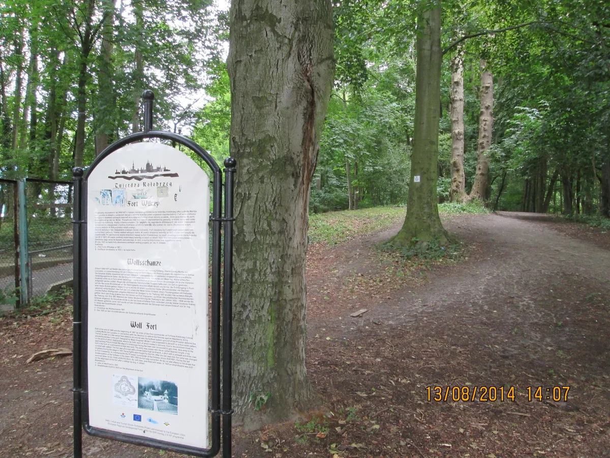
Two works by the beach on the eastern edge of the town belong to the same phase. Wilczy Fort (Wolf Fort; German Wolfsberg Schanze) was designed in 1807, when the French were approaching Kołobrzeg. Originally it had the shape of a three-armed star topped at the ends with blockhouses, and it was surrounded by a three-metre rampart and dry ditches with a palisade. After the modernisation of 1832-1836 it was named Fort Gneisenau, in 1925 it was rebuilt as an amphitheatre, and a municipal racecourse was laid out in the foreground. After the war, until the mid-1950s, the fort was in the hands of the army, and later it became an amphitheatre again. In 1968-1991 the Soldiers' Song Festivals were held here, and today it serves as a stage for concerts and open-air events. The heritage register lists it as a fort.
The Kamienny Szaniec (Stone Redoubt), formerly the Waldenfels Redoubt, was built in 1832-1836 on the seashore, at the place where in 1807, according to Wikipedia, the bloodiest fighting took place between the defenders of the fortress and the 1st Infantry Regiment of the Poznań Legion. Together with Wilczy Fort it formed the eastern system of fortifications. The German name commemorated Captain Waldenfels, and the Polish one comes from the wall of boulders that shielded the redoubt from the sea. Today it is largely a ruin, entered in the heritage register on 2 August 1967.
Demolition and what remains
When Kołobrzeg developed as a spa town, the authorities decided to abolish the fortress: according to Wikipedia the land fortress in 1872 and the sea fortress in 1887. The ditches were filled in and the ramparts removed, and the town grew rapidly. From 1887 the area around the Kamienny Szaniec was laid out as a recreational part of the spa, with a garden restaurant and a veranda by the sea. Kołobrzeg was declared a fortress once more on 28 November 1944, and the battle for the town lasted from 4 to 18 March 1945.
Many elements disappeared only after the war. The batardeau, that is a defensive bridge with sluices, was, according to Wikipedia, damaged in 1986 by sapper work on the Parsęta, and in 1987-1988 it was demolished on the orders of the authorities, without agreement with the conservator of monuments. The former works of the fortress lie far apart, so a walk is easiest to plan by location, from the centre through the port to the beach:
- Match Tower and Prison Tower in the centre, medieval walls;
- the port: Ujście Fort with the lighthouse and the Morast Redoubt on Salt Island;
- the Salt Redoubt on the Drzewny Canal and the Kleist Redoubt by the port;
- Wilczy Fort and the Kamienny Szaniec by the beach on the eastern side of the town.
The rules of entry to the individual forts and the redoubt are set by their managers, so some of them can be viewed only from the outside.


Be the first! Add a comment.
You need to log in to add a comment.
Log in