
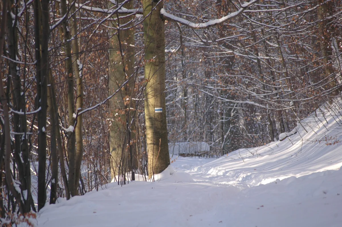
A dense network of marked walking trails runs around Szczecin, and most of them can be combined with a journey by train or bus. Below are the trails of the Beech Forest, the Warszewo Hills and the Wkrzańska Forest, with routes and lengths according to the sources. Long-distance trails, such as the Oder Valley Trail, which enters the Beech Forest, have their own overview.
Short and from a stop: Bukowiec and Słupi Głaz
According to the Association of Landscape Parks of the West Pomeranian Voivodeship, the Szczecin Landscape Park “Puszcza Bukowa” is crossed by 18 walking trails. The shortest begin at city bus terminals. Two trails start together from the terminal on the Bukowe estate, at Kolorowych Domów Street.
The black Mountain Trail to Bukowiec is 3.8 km long. According to Wikipedia, after 1.0 km it passes the Groński Boulder, a natural monument, after 2.5 km the Millstone known as the Heart Boulder, after 3.1 km the Siodło Zielawy saddle, and at 3.8 km it ends on the summit of Bukowiec. Wikipedia gives the height of Bukowiec as 148.3 m above sea level in the article on this trail and 149 m in the article on the Oder Valley Trail, so the height is about 148-149 m.
The red Wojciech Lipniacki Trail runs from the same terminal to the Czwójdziński Gate. According to Wikipedia it is 6.0 km long (the park authority gives 5.5 km), leads through the valleys of the Chojnówka, Zielawa and Rudzianka and passes the Lipniacki beech, the Chojna hillfort, the Swedish Mill, the Zielawa causeway and the natural monument Słupi Głaz. The name of Lipniacki, a lover of the Beech Forest, was added to the name of the trail in 1997.
Trails from the Krzywousty Oaks and from Zdroje station
In Szczecin-Klęskowo, at Chłopska Street, stand the Bolesław Wrymouth Oaks and two trails begin. The yellow Bolesław Wrymouth Trail is according to Wikipedia 13.6 km long, and according to the park authority 12.7 km. It leads through the Beech Hills past the Boulder of the Local Explorers, the Kołówko locality and the Lisica hill with a mast on Kołowo, and ends in Struga. On the way, in Płonia, stands a half-timbered church from the second half of the 15th century, and beside it grows the natural monument Lime of St Otto.
The green Bolesław Czwójdziński Trail is much longer: according to Wikipedia 34.8 km, from Klęskowo through the Czwójdziński Gate (2.0 km), Kołowo (5.2 km) and the arboretum in Glinna (11.3 km) to the abbey in Kołbacz (18.7 km), and then on to Lake Miedwie. The park authority describes only the section to Kołbacz, 19 km. It is a typical trail to be walked in sections.
The blue Stanisław Groński Trail is 38.2 km long according to Wikipedia and 39.6 km according to the park authority. It begins at Szczecin Zdroje station, passes the Chojna hillfort, the Groński Boulder, the Krzywousty Oaks, Lisica, Lake Plebanka and Lake Dereń, and Binowo, and ends at the Szczecin Zdunowo stop. Both ends are by the railway, so the route is easy to shorten.
A walk around Emerald Lake
The easiest on this list is the yellow Family Trail through Zdroje Forest Park. According to Wikipedia it is 2.5 km long, according to the park authority 2.7 km, and it leads around Emerald Lake (Jezioro Szmaragdowe). After about 0.5 km it reaches the Widok Glade with a panorama of Szczecin, and it ends on Skórcza Góra, a second viewpoint. The park authority notes that the trail is suitable for families with children. The lake was formed on 16 July 1925, when a water-bearing layer was uncovered in a chalk pit.
The Wkrzańska Forest and the Warszewo Hills
North of Szczecin, marked trails lead through pine forest and the hills above the city. The green trail through the Arkoński Forest and the Warszewo Hills is according to Wikipedia about 13.8 km long and leads from Niemierzyn through Osów and the southern part of the Wkrzańska Forest and through Przęsocin to Skolwin.
The red Boar Paths trail (Ścieżkami Dzików) is about 14.5 km long and begins in Niemierzyn, runs through the Arkoński Forest Park, Osów and Bogusław's Oak, and ends in Police-Mścięcino. The blue Peace Trail also passes Bogusław's Oak; according to Wikipedia it is about 12 km long and leads from Głębokie through Leśno Górne and Sierakowo to Pilchowo. None of these routes is a loop, so the return has to be planned with public transport.
Short approaches and branches are formed by the black Pilchowo Trail (about 4.2 km, with part of the route along village streets) and the black Komorze Hills Trail, 5.6 km from Leśno Górne through Stare Leśno to Tanowo. The yellow Police Trail is about 11 km long: from Chrobry Square in Police through Trzeszczyn and Stare Leśno to Bartoszewo. The longest is the red Stefan Kaczmarek Wkrzańska Forest Trail: Wikipedia gives about 44 km in the infobox and 45.5 km in the description of the route. It leads from Głębokie through Bartoszewo, Tanowo and Lake Świdwie to Trzebież on the Szczecin Lagoon.
On the eastern edge: the Rekowo Trail
The red Rekowo Trail is 16.7 km long and leads through suburban areas south-east of Szczecin, along the edge of the Goleniów Forest and the Płonia valley. According to Wikipedia it begins at Szczecin Załom station, passes the cemetery in Wielgowo, the Szczecin Zdunowo stop and the cemetery in Jezierzyce, and ends in Rekowo.
How to read these figures
The route descriptions of most trails in Wikipedia are based on the situation in 2007, and the differences in distances between Wikipedia and the park authority, visible above, result from different sources of measurement. Before setting out, check the signposting on the ground and a current map, because some routes cross roads and the motorway, and sections may have been changed.


Be the first! Add a comment.
You need to log in to add a comment.
Log in