
Before the brick and stone towns that we know today in West Pomerania there were strongholds: timber-and-earth fortresses on rises above rivers, straits and the lagoon. Little remains of most of them apart from the ramparts, yet a few can be seen on the ground, and some have been the subject of detailed archaeological research. Below are six places, each with its dating according to the sources, a description of the ramparts and information on what can be seen today. Discrepancies between the studies are stated directly.
Szczecin: a stronghold on three hills
The Wikipedia entry on the history of Szczecin states that the town was founded by the Wkrzanie (Ukrani) at the turn of the 7th and 8th centuries on today's Castle Hill. Elsewhere in the same entry, the oldest traces of early medieval settlement go back to the end of the 9th and the beginning of the 10th century, and the Slavic princes then built a stronghold surrounded by a moat. The entry on the town itself says, in turn, that Castle Hill has been continuously inhabited since about the year 700, that the oldest stronghold settlement has a tribal origin reaching back to the end of the 8th century, and that the stronghold with a moat was built in the 9th century. The dating of the beginnings is therefore inconsistent and depends on whether one counts the first settlement or the fortified stronghold.
According to Wikipedia the stronghold was oval in shape, narrowed in the middle, and consisted of three parts: the stronghold, the suburb and a trading and fishing port. It extended over the marshy ground of the left bank of the Oder and over the island of Łasztownia. The description of the temples comes from the lives of Otto of Bamberg: Ebbo wrote that the town contained three hills, and the middle and highest was dedicated to Triglav. Pomeranica, that is, the Encyclopaedia of West Pomerania, links the court of Duke Warcisław with the fortifications by this pagan temple and identifies the place with the north-western part of today's Castle Hill. Today the Ducal Castle stands on the hill, and on the site of the Church of St Peter and St Paul the first wooden church, from the time of Otto's mission, was built, according to Wikipedia, in 1124. The ramparts of the stronghold cannot be seen, but the outline of the hill above the Oder can.
Cedynia: a stronghold at the Oder crossing
According to Wikipedia, in Cedynia, on the site of a Lusatian culture settlement from the 7th-6th century BC, a stronghold of the local Slavs was built in the 9th-12th centuries, guarding the crossing of the Oder on the road linking the Elbe region with Pomerania. Around 960 it was taken by Mieszko I and extended as a border fortress, and the site of the battle of 972 is also identified with this stronghold, although its location has at times been disputed. Today's Cedynia hillfort is surrounded by ramparts and has a section of reconstructed palisade, and the Regional Museum also stands there.
The excavations were carried out by the National Museum in Szczecin: according to the entry on the Regional Museum in Cedynia, the hillfort, the suburb and the cemetery were investigated in 1958-1959, 1961 and 1967-1985. Finds from this work are displayed by the Regional Museum in Cedynia, about 200 metres from the hillfort. The hill with the battle monument, Czcibor Hill, lies four kilometres away and is not part of the stronghold.
Lubin: a stronghold on the highest cliff of the lagoon
The stronghold in Lubin on Wolin Island lies on the highest cliff on the coast of the Szczecin Lagoon, 43-52 metres above sea level, about 8 kilometres from Międzyzdroje. According to Wikipedia the oldest traces of settlement date from the 9th or the first half of the 10th century, and the settlement was surrounded by a rampart probably at the end of the 11th century. The rampart was of sand and clay, and the palisades may have been fixed to a stone foundation. After its destruction at the end of the 12th century it was rebuilt on a slightly different line, and the rebuilding was dated by the radiocarbon method to 1170-1180. According to Wikipedia it is not known whether the rampart formed a full ring or protected only the landward side.
In 1124 Otto of Bamberg came to Lubin and, according to Herbord, consecrated an altar here, and in 1173 the stronghold was taken by the troops of the Danish king Valdemar I. The last mention in a document dates from 1186 or 1187, when it was granted to the Kamień chapter. In 2008-2011 archaeologists from the University of Szczecin and the Institute of Archaeology and Ethnology of the Polish Academy of Sciences investigated more than 350 square metres and uncovered the remains of the Church of St Nicholas with a cemetery, in which the remains of 71 people were found, as well as two ramparts. According to Wikipedia the church was at least 10 metres long and more than 7 wide. From the Lubin hillfort one now sees above all the panorama of the lagoon, and of the old buildings only the foundations of a late medieval residential tower under a protective roof.
Kołobrzeg-Budzistowo: the first Kołobrzeg
Budzistowo, in German Altstadt, lies on the Parsęta River, about 4 kilometres from its mouth, and according to Wikipedia it was the place where Kołobrzeg stood before its chartering. The entry on the hillfort speaks of an open settlement from the 8th-9th centuries and a stronghold from the second half of the 9th to the 13th century. The hillfort has two parts: the stronghold proper measures 150 by 250 metres and covers about 2.6 ha, and the southern suburb measures 110 by 30 metres and covers about 1.3 ha. Traces of the rampart can be seen in the northern part of the site, and at the foot also remains of the moat. Lech Leciejewicz's hypothesis of a stone cathedral of Bishop Reinbern on the site of the stronghold is, according to Wikipedia, unconfirmed. The entry on the village adds that the timber-and-earth rampart is visible to this day. The village is also home to the Church of St John the Baptist, which the heritage register dates to the 13th century.
Gardzka Kępa: a stronghold on an island in the Dziwna
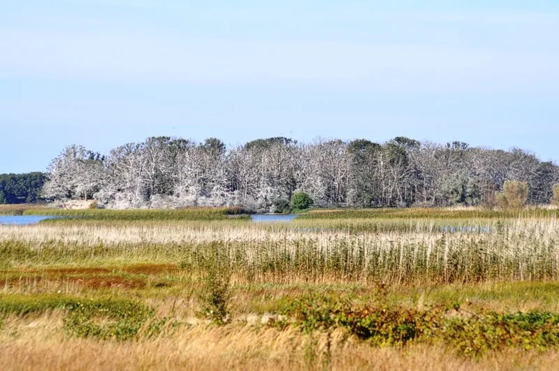
Gardzka Kępa is an island on the eastern bank of the Dziwna strait, near the village of Połchowo in the municipality of Kamień Pomorski. According to Wikipedia, in the 10th-12th centuries a stronghold attributed to the Wolinians stood here, on the waterway linking Wolin with Kamień Pomorski. The German name of the island, Burgwall, comes from this stronghold. The rise is 230 metres long and 170 wide, and its height is 4.5 metres above sea level. It is separated from the mainland by a strait about 20 metres wide, overgrown with reeds. In 1846 fragments of Slavic pottery were found here. The outline of the ramparts is visible on the ground, and the Wolinian hillfort lies in a zone of full archaeological and conservation protection and in an area overgrown with old oak trees, with a large breeding colony of cormorants and herons.
Kamień Pomorski: a stronghold on the Dziwna
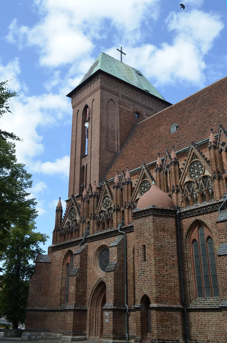
According to Wikipedia, Kamień Pomorski arose as a Wolinian settlement at the turn of the 8th and 9th centuries; in the 9th-11th centuries it was a fishing and port settlement, and the stronghold probably arose in the 10th century. In 1124 Otto of Bamberg was active in the town, and in 1175 the seat of the Pomeranian bishopric was moved here from Wolin. Nothing of the old stronghold can be seen, but on the suburb a wooden Church of St John the Baptist was built, and on its site a cathedral, today a co-cathedral. Wikipedia dates its construction to 1172-1176.
Be the first! Add a comment.
You need to log in to add a comment.
Log in