
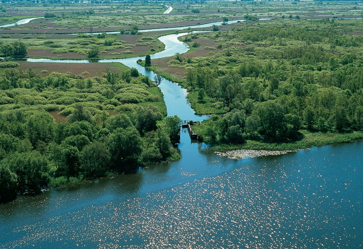
The Międzyodrze (the Oder floodplain) lies between two branches of the Oder: the West Oder and the East Oder, called the Regalica. According to the Encyclopedia of West Pomerania it covers the area north of Widuchowa up to the Iński Nurt canal and the islands between the Oder and Lake Dąbie. Its territory is divided among four municipalities: Widuchowa, Gryfino, Kołbaskowo and the city of Szczecin. From a distance it looks like a wild river valley, but it is a landscape shaped in large part by engineers.
Two Oders, one of them dug
The fork of the Oder begins near Widuchowa. According to Wikipedia, the West Oder is the river's original channel, while the East Oder from Widuchowa to Gryfino was created as an artificial cut. Wikipedia writes that this cut was made at the beginning of the 20th century, together with a two-kilometre cut on the West Oder which shortened a meander of the old channel, today called the Węzłowy Canal. At the beginning of the West Oder a sluice weir 78 m long was built in 1914. According to the same article it was meant to direct water into the new channel of the East Oder and protect the West Oder from excessive flow and erosion. Today most of the Oder's waters flow through the East Oder, and the weir still regulates the flow.
Canals, polder and pastures
The Encyclopedia of West Pomerania links the transformation of the Szczecin Międzyodrze with the building of the port of Szczecin and the easing of navigation on the Oder. Many canals were dug or parts of rivers were filled in, which changed the shoreline, and some islands were separated. Wikipedia adds that the greatest influence on the present appearance of the Lower Oder Valley came from the period of the Province of Pomerania, when numerous canals were dug, hydraulic structures were built and part of the area was adapted for industry, agriculture, livestock farming and navigation.
In the southern part of the Międzyodrze the main concern was agriculture. According to the entry on the Lower Oder Valley Landscape Park, the network of oxbow lakes, canals, ditches and backwaters totals more than 200 km, and some of it formerly served for land drainage. Many historic hydraulic structures remain from it, which regulated the water level mainly in order to maintain pastures and protect the area from flooding. Wikipedia describes the Lower Oder Valley as an area with canals, oxbow lakes and polders. In the interwar period, as the entry on the park writes, investments in agricultural use of the Międzyodrze consumed considerable funds but did not bring the expected results.
After 1945: a landscape without maintenance
After the Second World War, according to Wikipedia, agricultural activity and the maintenance of hydraulic equipment were abandoned. The border character of the area made it practically impossible for people to move around in it. Nature then returned to the state before the hydrological works: today the Międzyodrze is flooded depending on the water level in the Oder and covered with sedge beds, reed beds, willow thickets and alluvial forests. The Lower Oder Valley Landscape Park, established on 1 April 1993, covers according to Wikipedia 6,009 ha of the Międzyodrze.
This landscape can be viewed from a kayak. The Lower Oder Valley Landscape Park describes four kayak routes, and the park's manager advises not to count on a walk on foot on the Międzyodrze itself: bridges, footbridges and locks are destroyed, and the canals cannot be crossed on foot.


Be the first! Add a comment.
You need to log in to add a comment.
Log in