
From stronghold to town of the Neumark
Drawsko Pomorskie lies in the Drawsko Lakeland, on the Drawa, and within the town boundaries there is a small lake, Okra. According to Wikipedia, a first stronghold and settlement existed here as early as the 7th century, and in the 10th to 12th centuries a Pomeranian stronghold stood on this spot on the border with Greater Poland. The location on the road from Greater Poland to the Baltic favoured the development of the settlement, but at the end of the 13th century it was taken over by Brandenburg.
Drawsko received town rights on 8 March 1297 from Margrave Waldemar, as Wikipedia states. The town then became part of the Neumark (New March). According to the same source, the first reeve was Arnold von Goltz. In the 14th century town walls were built which made Drawsko, according to Wikipedia, one of the more important strongholds of the Neumark, and around 1350 the New Town was founded on the left bank of the river. To this day the remains of the defensive walls from the 14th century are entered in the voivodeship heritage register.
The history of the town was interrupted by fires and wars: a great fire in 1620, further ones in 1664 and 1696, and in 1626, during the Thirty Years' War, the town was ruined by the Lisowczycy. In 1818 Drawsko County was created, and in November 1877 the railway line from Runowo reached Drawsko. The German name of the town was Dramburg; the name Drawsko was introduced officially in 1946, and in 1948 it was changed to Drawsko Pomorskie.
Churches and town hall: what remains of the old town
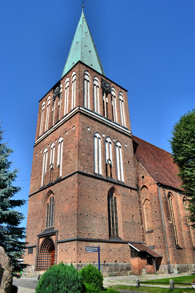
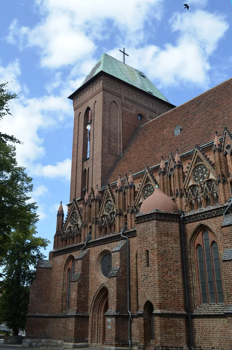
The oldest historic monument is the Church of the Resurrection of the Lord. Wikipedia describes it as a late Gothic hall church with three aisles, an octagonal apse and a tower 75 metres high. Construction lasted from the middle of the 14th century, when the foundation stone was laid, to the middle of the 15th century, when the tower was completed. The fire of 1664 brought down the Gothic vaults, and they were rebuilt in 1913. The most valuable features are the side portals decorated with reliefs fired in brick: dragons, mermaids, centaurs, knights and unicorns. The interior is decorated with a wooden high altar from 1705-1706.
In the interwar period the town gained new places of worship. The Church of St Paul is a neo-Romanesque building from 1928-1929, and the former Baptist church stands on Boczna Street. Wikipedia also lists in the heritage register a half-timbered salt warehouse from about 1700 and a house from 1906, designed, according to this source, by Walter Gropius.
The town hall on Eliza Orzeszkowa Square was built in 1907-1909. The Wikipedia entry on the town hall describes it as an eclectic building with a mansard roof and a griffin on a neo-Baroque pediment, while the list of the town's historic monuments calls the same building the county office. At the same time this list contains a separate entry: a town hall from the end of the 18th century at Ratuszowa 5, today a residential house. Two buildings of this name are therefore not the same structure.
A trace of the former multi-faith community is the Jewish cemetery, which according to Wikipedia still exists in the town today. The history of the Jews in Drawsko is described by the Virtual Shtetl portal.
1945 and its remembrance
Drawsko was taken on the night of 4 to 5 March 1945. According to Wikipedia, this was done by the 4th Pomeranian Jan Kiliński Infantry Division in cooperation with Soviet units. The entry gives official figures of 16 fallen Polish soldiers and notes that the town's mayor spoke of 40 graves of Polish soldiers, so the number may have been higher. The buildings and fabric of the town were destroyed in the fighting by about 50 per cent, according to the same source. The fallen are commemorated by the war cemetery, a place of quiet in which conduct appropriate to the place is expected.
The Drawsko training area beyond the town
To the south of the town stretches a military training area known to residents and tourists as the Drawsko Training Area (Poligon Drawski). The entry on the military unit states that it was established on 2 February 1946 and that its area is 33,968 hectares, of which the working field occupies 11,420 hectares. The same entry calls it the largest facility of this type in Poland, whereas the article on the town itself writes more cautiously: one of the largest training areas in Poland and Europe. The training area lies in the southern part of the municipality of Drawsko Pomorskie and the northern part of the municipality of Kalisz Pomorski.
The beginnings of the institution were more modest than its present name. According to Wikipedia, the unit was created as the Command of the Artillery Training Area and was first located in Jelenino near Szczecinek. In 1949 it was moved to Oleszno, and from 1957 the unofficial name Drawsko Training Area began to be used. In September 1996 the first exercises of Western forces were held here, in which the British 7th Armoured Brigade took part. As early as the 1930s the military garrison in Drawsko was expanded, which the entry on the town records.
What the training area changes in the surroundings
For visitors the restrictions are important. The southern shore of Lake Lubie, on the Karwice side, is overgrown with the Karwice Forest (Bory Karwickie), in which the training area lies, and according to Wikipedia this part is inaccessible to civilians. Tourism is developing on the other shores of the lake, which lies about 3 kilometres from the town. The stretch of the Drawa between Lake Dąbie Wielkie and the Borowo hydroelectric power station is also closed: paddling is forbidden there because, according to Wikipedia, it is the central point of shell impact, and the river has not been cleared of unexploded ordnance. As a result the kayak route down the Drawa is divided into a northern and a southern part.
It is about 85 kilometres from Drawsko to Szczecin and about 90 kilometres to the sea, as Wikipedia states. On national road number 20 the town is a good base for trips to the lakes of the Drawsko Lakeland, and the church, town hall and fragments of the walls can be seen during a single walk around the Old Town.
Be the first! Add a comment.
You need to log in to add a comment.
Log in